Peru
2003
The
Cotahuasi Canyon
July 19 - July 31
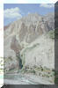
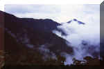
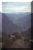
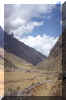
Cotahuasi Canyon is the deepest canyon in the word, deeper by
far than the Grand Canyon. This adventure
offers stunning canyon walls, a wild river below your path, ruins and a string
of Quechua villages all along the way. This backpacking trip is well worth the
effort.
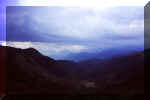
The canyon is reached
after a grueling and uncomfortable 12-hour bus ride from Arequipa. The bus
leaves in the late afternoon, which gives little time for scenery. Sadly, the
return from the town of Cotahuasi also leaves in the late afternoon, but at
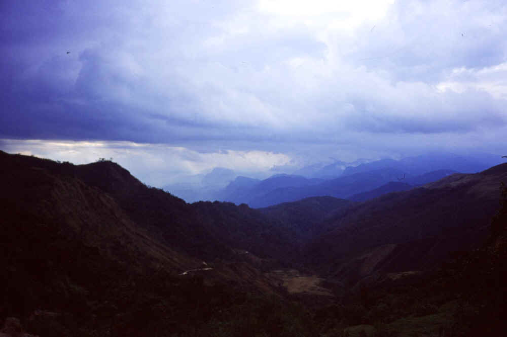
least one can see a few hours of remarkable landscape before the sun sets.
Cotahuasi Canyon is
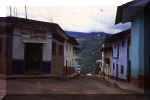
scarcely hiked by backpackers---I saw none. The town itself presents a contrast
to Cabanaconde, which is the town serving as the beginning of the Colca Canyon
hike which I did one year ago. (Colca is the second deepest canyon in the
world.) It is not really set up for tourism. I tried every restaurant in town to
get a dinner with a beer, and it was impossible. This is outrageous, of course.
But it also means you will have the whole place to yourself.
I stayed in the Hostal
Huntahuasi ($3 a night, full board available) which offers a family
atmosphere and comes highly recommended---by me.
I spent 8 days walking
the canyon. One could hike it in four or five, but such a pace would deny you
much of the reason for backpacking there in the first place. Everywhere and at
all times you are surrounded with dizzyingly high canyon walls, a ridiculously
vertiginous path, a roaring river at times hundreds of meters
below and the occasional local walking with his mule.
There are concerns here,
as with any place. These are sun, wind, dust, height and disease---Chagas
Disease, to be exact.
Sun: There is
little shade anywhere, and none at all while on the trails. You must lather on
the sun block or you will suffer dearly from severe sun burn. The tropical sun
has enormous burning power and reflects off the rocky trail and the canyon
walls. Take this warning seriously or your trip will be ruined. Where a
wide-brimmed hat and sunglasses.
Wind: At times
the path along the canyon wall is dangerous. There are parts where a
sudden gust could put you over the edge of the trail and into oblivion far
below. Take heed. If the day is windy consider waiting out the wind.
Dust: It is everywhere
and gets into everything. You just have to get used to this.
Height: Those with vertigo should avoid this hike. Many
times the trail seems such a
trifle as the canyon walls rise far overhead and the river rushes by far,
far below.
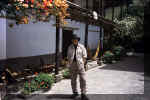
Chagas Disease: This
is carried by a bug that lives in the typical wattle and mud houses built by the
Indians who live in the Andes. You will see this type of house in the canyon.
This disease once depopulated several villages along this route but now
the government has taken strides to eliminate the bug. Always
sleep in your tent, do not sleep in one of these houses. If you must then
soak yourself with DEET. Keep a candle burning all night.
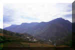
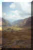
Good places to camp are
about three hours apart. There is usually no water except at these wild
campsites. You will be walking from Cotahuasi - Sipia - Chaupo - San Cay -
Velinga - Huña - Quechalla, and then return mostly the same way. Until
Quechualla you will be walking mostly downhill. There are no supplies available
after leaving Cotahuasi.
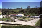
|

Sipia |

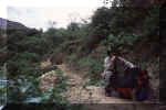
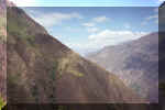
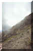
Between Sipia and Chaupo |
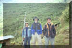
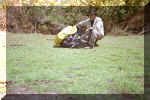
Alcides Llamoca |

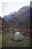
Camping at Alcides´ house |
|

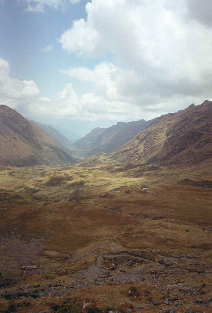
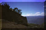
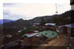
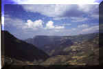
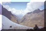
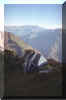
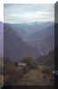
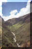
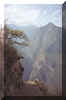
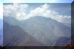
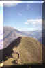
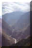
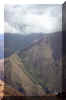
The Cotahuasi Canyon |

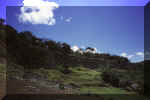
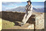
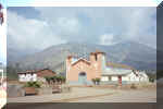
San Cay |
Near Velinga |

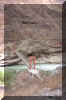
Typical footbridge |
|
Walking above the river |

Quechualla |

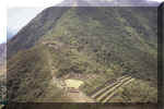
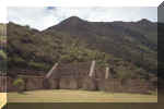
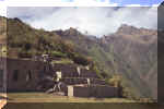
The ruins at Huña |

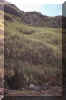
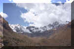
Typical canyon view |
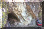
DAY 1
Walk out of the town toward
Sipia. These are 150 meter falls whose roar you will hear long before you get
there. There is a road about two-thirds of the way, but many switchbacks taken
by the locals who walk---and they all walk. You will be crossing two brides,
one of concrete and the other a rickety foot bridge. Ten minutes before the
falls you will see the path divide, the left going to Chaupo, the right going
to the falls. Time: 3 hours.
DAY 2
Backtrack a bit to the
fork that goes to Chaupo. This is a little village inhabited by perhaps twenty
people. There are excellent camp sites here and lots of water. I stayed with
Alcides Llamoca, a worker on one of the little farms in the village. Time: 3
hours.
DAY 3
One-half hour out of Chaupo you will
come to another fork, the left going up to the attractive village of San Cay,
the other continuing across a dry pampa to the village of Velinga. I went to
San Cay, where there are many campsites and plentiful water. As soon as I arrived
some locals gave me chicha, which is a mildly alcoholic drink made from
corn that has been well-chewed and then fermented. This produces a liquid with
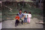
an entertaining taste---but just forget it has been made with saliva. I was surrounded by curious children my entire time there, so my ideas
of solitude went out the window. Time: 3 hours.
DAY 4
There are two routes to Velinga, one of which is extremely dangerous with a backpack on. This route
leads out of the village toward Velinga, which soon becomes visible lying on a
Pampa far below. Take a photo, and then return to the village without continuing
on this trail. I attempted it without my pack and almost fell to my death---or
at least it seemed that way. You will have to backtrack a bit to the first ridge
that rises on the trail leaving the village. Ask the locals the proper way. You
will be dropping to the trail that goes to Velinga further down the canyon. I
did not enter the village as I did not want to be the center of attention again,
but camped along the river. Time: 3 hours.
DAY 5
You will be heading toward Quechualla, which is the
last village along the river. There is a bridge across the river here that leads
to a pampa high above. Do not take this, but continue down river. You will soon
cross another bridge, and then one hour later you will arrive at the ruins of
Huña. These are much larger than Machu Picchu, but dilapidated. They extend for
about a kilometer. I camped in them---an unforgettable experience. Where else
can one camp alone in ancient ruins? At night I heard the voices of the
long-dead Inca. You probably do not believe me but no matter. You were not
there. Time: 3 hours.
DAY 6
Continue to Quechualla, about one hour
away after crossing yet another bridge close to the ruins. Here I stayed for
about an hour before heading back to my campsite below Velinga. Time:
4 hours.
DAY 7
Leaving the campsite
below Velinga, head for Chaupo by the route that avoids the climb to San Cay.
You will be walking among huge cacti. I stayed another night in Chaupo with
Alicides. Time: 3 hours.
DAY 8
I made it all the way back to
Cotahuasi because I was lucky enough to find a ride at the end of the road that
goes to Sipia from Cotahuasi. Time: 4 hours.

The ruins of Kuelap and Gran Vilaya
August 12 -
27
Without
question this was one of my finest and most rewarding backpacking experiences.
It offers everything: stunning landscapes, an entire valley filled with ruins,
Inca roads, water and wild camping all along the route, a string of remote
villages and not another gringo in sight. It is not easy though, and presents a
backpacker with some tough challenges. There will more than likely be
rain; you will be reliant upon your own resources and those of the locals you
meet; the total descent and ascent over 13 days approaches 10,000 meters.
I
would be hesitant to do this hike without reasonable Spanish, absolutely
reliable equipment, knowledge of emergency medicine and long experience in
difficult hiking. You will need two topographical maps of this region, Chachapoyas
and Lonya, both available from the Instituto Geografico Nacional in
Lima. GPS experience and land navigation skills are not really necessary unless
you plan to venture far a field from the route below. You should carry 10 days
worth of provisions. Some is available on route, but no fuel. Locals will cook
meals for you and let you sleep in their house or pitch your tent in their yard.
Here you will have an outstanding opportunity to see rural Peru at its most
remote.
This
walk begins at the town of Chachapoyas, reached by a 22 hour bus ride from Lima,
or---better---11 hours from the city of Chiclayo. This city itself boasts some
fine ruins at the sites of Túcume and Sipán.
Chachapoyas
is named after the people who lived in the area from c. 1000 AD until the
Spanish conquest (1531-1533). They were organized in a series of mutually
independent city-states much like the ancient Greeks. They were usually at war
among themselves---again like the Greeks---and could not present much of a
united front when the Incas came around 1450. Warfare being the rule, their cities were
built around hilltop fortresses---as were the Greek city-states---among which
Kuelap
is a fine example. Roads stretched between each Chachapoyan city, and it was the
discovery of these roads by Gene Savoy in the 1960s that led to the opening up
of the area to archeologists. So far more than 80 lost cities have been
discovered, and scientists believe far more lie buried between the rivers
Utcubamba and Marañon.
|

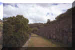
Near one of the three entrances of Kuelap |
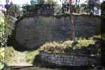
Exterior wall of Kuelap |
Another view of the exterior wall |
Lonya Grande |
|
Levanto |
Ocalli |
Resting along an Inca road near Vilaya |
Family near Vistahermosa |
|
Forest near Abra Yumal |
View of terrain in Vilaya |
Chilling at El Chillo |
Landscape near Chachapoyas |
|
Landscape near Ocalli
|
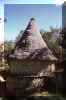
Typical Chachapoyan house at Kuelap
|
Interior wall at Kuelap
|
DAY 1
The
walk to the village of Levanto will take 5 hours. It is on an almost perfect
Inca road. Bring water and sun screen. Levanto was one of the great
Chachapoyan centers. Above it 30 minutes away are the extensive ruins of Yalape.
I stayed 2 nights at one of the Tambos Chachapoyanos, a series of hostals
built by American
Charles Motley to bring
more tourism to the area.
DAY 3
The
next stop is half-way to Magdalena and Tingo, which are really sister villages
along the Rio Utcubamba. Head out of Levanto on the road toward Mayno. After 30
minutes you will see a definite trail leading off to the right and down---way
down---to a valley. There is water along the way. I camped in the valley along a
river after three hours of walking.
DAY
4
The
trail continues on the left bank of the river and heads upwards to a road. You
will have to scratch around a bit. Eventually you will come to the obvious route
to the Utcubamba, and then on to Magdalena and Tingo, both visible while still
an hour away. You will see the difficult route to the ruins of Kuelap as it
winds up from Tingo. You can stay in Magdalena or at
El
Chillo, about one hour more along the river. Here there is hot water,
full board and a family atmosphere---highly recommended. I stayed two nights
and washed clothes, explored the area---including an Inca road that leads into
Magdalena---and enjoyed cold beer. I walked five hours from the valley to El
Chillo.
DAY 6
The South American Handbook mentions a route to Kuelap
from El Chillo, but landslides have taken it away. (I had taken this route in
1997.)To get to Kuelap you have
three options: take a taxi, walk the boring route from Tingo, or enter from the
village of Nogalcucho. I chose this route. The village is a 30 minute walk along
the road that goes to Leimabamba from El Chillo. It is far more interesting than
the walk from Tingo, but takes longer. You walk along a river on a gentle ascent
until the trail veers sharply upward to your right about two hours from
Nogalcucho. I camped right before the ascent near a small and vacant campesino
house. If you choose to carry on from here you should know that water is
scarce until you reach the first village some hours above.
DAY 7
This day will take you right to the ruins of Kuelap, known
locally as la fortaleza. The obvious trail ascends for three hours
through farm land. The ruins will be visible while you are still two hours away.
You can either camp at the government sponsored hostal right below them or stay
at a local hostal, El Bebedero, very nearby. I stayed there two nights as
there was beer to be had and meals were served. The ruins will take all day to
explore.
(By the way, it is written that Kuelap has more stone than the
Great Pyramid at Giza. This is absurd. Kuelap was built using 100,000 stones
while the Great Pyramid boats 2,300,000, each much larger than any at Kuelap.
Napoleon calculated that the stones from the pyramid could from a wall around
France 12 feet high and 3 feet wide---which is an idea still worth considering.)
DAY 9
The next stage of this hike will take you to the village of
Choctamal, which is the entry point to the Gran Vilaya region. You can walk the
five hour road that leads from Kuelap to Choctamal or arrange transport from the
parking lot behind Kuelap as I did. The reason was that the road was dusty,
there was no shade and many combis and taxis heading to and from either Tingo or
Kuelap made walking unpleasant. If you do walk plan on breaking the hike at the
village of Maria, about half way to Choctamal. There are a number of hostals
there. I stayed at another of the Tambos Chachapoyanos right before
Choctamal.
DAY 10
Now begins the real journey, the descent into Gran Vilaya. Head
toward the pass at Abra Yumal about 4 hours away; it is all uphill on a road.
There is OK camping and water on the way, but why dally? Once at the pass, you will
see what remains of the road heading to your left, a trail heading to your
right,
and trail descending steeply into a valley---this is your path. There is camping
and water about 30 minutes in.
DAY 11
For the next 6 - 7 hours you will be descending from a cold
cloud forest to a tropical valley, that of Gran Vilaya. It is a drop of one
mile, and can be a bit precarious after a rain. There is much mud; walk with
care. There is also much traffic, as the locals use this trail as a highway to
transport goods from Choctamal to the valley. You will encounter many mules and
horses on route, a good thing if you get injured and need some quick
transportation out. I stayed with a family in the village of Vistahermosa. There
are some supplies available here, mainly sodas and crackers.
DAY 12
From Vistahermosa you have choices: you can take the usual route
and go to Belen, which is a plateau about 6 hours from Vistahermosa---all
uphill. Or you can head down the valley to the village of Ocalli two days away.
Since this was the road less taken, I chose it. Ask locals for advice, and also
for assistance in getting to the many ruins spread all around the area. I walked
three hours until some rain blew in, and so I stayed with a family in San
Felipe.
DAY 13
From San Felipe the route is very up and very down as you
traverse a canyon and its many comings and goings. I camped at a river after
about 4 hours of this.
DAY 14
I made the village of Ocalli after four long hours of
ascents and descents. There is only one place to stay, the San Simon Hostal.
Transport leaves every morning for Lonya Grande. Ask the locals.
Your backpacking ends at Ocalli. You can make Lonya Grande in 5
hours in a truck---a very rough road. From Lonya you can make connections to
Jaen and on to Chachapoyas.
Cachora
- Choquequirao - Huancacalle
September 9 - 21
This was one of the most
difficult expeditions I have ever done---no, it was the most difficult. There
are several reasons, among them being the 10,000 meters of climbing and
descending it entails, and the two passes you must cross---one at 4200 meters,
the other at 4600. It was also the most rewarding in my career---rewarding
physically, mentally and spiritually.
Like all my expeditions,
this was done solo. Undoubtedly going alone increases the difficulty. I cannot
recommend it for the solo hiker unless he has a great deal of experience, good
equipment (state-of-the-art gear is not necessary), a working knowledge of
emergency medicine and is in superb shape. All expeditions must be
self-sufficient, for little is available en route, at times not even water.
One of the many
highlights of this hike is the Inca ruins of Choquequirao. The site of this city
astonishes even those used to such things, compared to which Machu Picchu seems
but a trifle, a touristy theme park full of the wide-bottomed and spandex clad.
On a normal day Machu Picchu seems to have more visitors than a typical day at Disney World. I was alone in Choquequirao, with nothing to disturb but the ghosts of Inca
long dead.
Your gear must be able
to handle wind, rain, cold and icy nights. Over the ankle Gore-Tex boots are
strongly recommended, as is a down sleeping bag suitable for at least -15
centigrade. A full medical kit must be carried, including a wide-spectrum
antibiotic and an emergency splint if bad luck follows you into the mountains.
One hundred percent DEET is required, for there are ferocious biting flies the
entire way, though fewer of them at altitude. All water must be treated with
iodine, six drops per liter.
|
Terracing at the ruins |
The entrance to the ruins |
Camping in pampa after Yanama |

Choquequirao
|
|
Choquetacarpo Pass
|

View of the Apurimac
|
Mine entrance on the way to the pass at
Choquetacarpo
|

Looking toward Huancacalle
|
|
The ruins
|
500 year-old mine at 4000 meters
|
What real camping should be
|
Approaching the 4600 meter pass
|
View
from entrance to ruins
|
Looking
toward the Rio Victoria |
Resting at the ruins |
With two rangers
|
|
Approaching 4600 meter pass |
Bridge over Apurimac |
Resting after Yanama |
Approaching 4600 meter pass |
|
On the way to Chuquisca |
View from the ruins |
Cachora |

Choquequirao |
|

Choquequirao |
Choquequirao |
Near the ruins |
View from the top |
|
Choquequirao |
View toward the Apurimac |
Toward the 4200 meter pass |
View from the ruins |
DAY 1
Take a bus from Cuzco
going toward Abancay. Ask to be let out at the road to Cachora, about 4 hours
from Cuzco. From there it is a 2 hour walk far down to the village. There are
two hostals there. I do not recommend continuing unless you arrive at noon or
earlier, as between Cachora (2932 meters) and the first reasonable camp site there is no
water.
DAY 2
You begin the day
walking out of town on a clear path that eventually leads all the way to
Choquequirao. The trail drops down and after about 30 minutes you will come to a
valley. Keep to the left and begin a slight climb to a ridge from where you
get your first view of the Rio Apurimac far, far below. Continue on a hard
descent to Santa Rosa, about 4 hours from Cachora. Here is fine camping and
plenty of water, and a family that might cook meals for you.
DAY 3
The next day you
continue descending to the Apurimac (1700 meters) 1 hour away. You may camp here
if you wish. Cross the bridge and begin the
hard climb to Chiquisca, 3 hours from the river. There is good camping and water
here.
DAY 4
Choquequirao (3088
meters) is about 4
hours away on a clear trail that alternately climbs and descends---mostly climbs.
Along the way there is water and 1 hour from the ruins are some farms that have
set themselves up as purveyors of tourist wares: Coke and bottled water is
available, and you might be able to coax a family into cooking you a meal. When
you get to the entrance to the reserve where the ruins are, and if the rangers
are not there, you can either wait for them to return or continue for 30 minutes
along the trail that goes behind the rangers´ facilities to the obvious ridge
to your right. The ruins are there. You can camp in the terraces but there is
only a little drip of water. I stayed with the rangers for two nights. They are
a wealth of information of the route ahead of you.
DAY 5
I stayed with the
rangers, hung out in the ruins, and generally prepared for the days to come.
This extra day paid off.
DAY 6
Well rested from your
time at the ruins, you are ready for the hard stuff---and it is hard.
(You will have to trust me here.) The trail first takes you to the Rio Victoria
(1750 meters) 4 hours away. It climbs hard from the ruins for about an hour. At a grassy
pampa you can see your destination, an amazing 1700 meters below. You can also
see the next day's destination high up along a ridge across the valley to your
right. There is no water until the river, but---alas!---there are several good
camp sites. Once at the river the flies become a motley and biting throng.
Across the Rio Victoria there are campsites around 15 minutes from where you
descended.
DAY 7
Your route today will
take you 1700 meters straight up---or so it seems. Your destination is Maisal, a
collection of huts about 4 hours from the river. There is water here, but you
will have to share it with pigs, dogs, chickens, horses, mules and humans. Drink
up, as there is no other water until long after you cross the 4200 meter pass
that awaits you. You may camp at Maisal (3400 meters).
DAY 8
Carry at least 5 liters
of water for this day and part of the next. You will be continuing up another
800 meters or so. The climate and fauna change remarkably as you leave Maisal
and climb to the first pass. It becomes much colder, and there are fewer
flies---but they still pursue. You will see holes dug into the hard rock about 3
hours from Maisal, and then 2 hours later you reach a 500 year-old lead and
silver mine (4000 meters). Here there is good camping but no water. Make the best of it.
DAY 9
Head up along a trail
with the mine on your right. One hour later you come to the pass (4200
meters) from where you
will get a view of the trail you will follow the next day: it stretches across
the valley to your left and ascends to a pampa. Head down to the village of
Yanama, where there are some provisions available. Continue to the river (1750
meters) and
cross a bridge about an hour from the village. There is good camping and water
on a pampa right above the river. Here I washed clothes and had a bath of sorts.
The flies here are bold but slow. Kill as many as you can.
DAY 10
There will be no more
water worries from now on. Head up to the pampa you saw the day before. Here
there is water and camping, but it is only 2 hours from Yanama, so you will
probably wish to continue. The trail is obvious and leads to the next pass at
4600 meters. You will not make it that day as it is another 6 hours from the
pampa. You will be walking along a ridge high above river and valley which
eventually narrows 4 hours from the pampa into a beautiful grassy plain where
there is plentiful water and camping enough for a Roman cohort.
DAY 11
This part of the hike is
certainly the most stunning, with rocky outcroppings, sheer icy towers far above
and snow-capped peaks staring down at you. The pampa where you camped narrows to
a valley. The path goes right through the middle of it, where soon appears
an amazing Inca trail that leads to the pass and beyond. You will see another
clear trail to your left. Stay away from it unless you want to suffer a stiff
climb that actually leads to the pass but on a round-about route that is not
much fun. (Now, how do I know this?) There is fine camping and abundant water
all the way to the last part of the trail below the pass. I camped here. Upon
awaking my rain-fly was covered with ice. Be warned, it is cold, windy and bleak
here.
DAY 12
This pass is difficult,
and can be dangerous---it was dangerous---early in the dry season as there was
some tricky ice and snow the final 1 hour ascent. A trekking pole would be handy
here. Once at the pass enjoy the views of the valley far below where you will be
walking. From here it is a hard and long 5 hour descent to the road at the
village of Huancacalle (3000 meters). I stayed at the Six Pack Manco Hostal. There is
regular transport from this village to the real city of Quillabamba 4 hours
away, and then on to Cuzco another 8 hours further.
Home
Professional Pages
Personal
Pages
Sabbatical
Itinerary
Essays
Backpacking
Entries
Diary
and Commentary
Search
E-Mail